
Exploration

Why is passive collection important?
What are the benefits of passive rainwater collection? Rainwater is useful for all your water needs. Some of the benefits include the following:
- Helps us to reduce our dependence on treated municipal water, which is often carbon-intensive, expensive, and sometimes unavailable.
- Reduces the amount of water runoff. This is especially important in urban areas, where 90% of water is lost to runoff from impervious surfaces. When there is excess runoff and the sewer system cannot handle the volume, raw sewage can be discharged into surrounding areas.
- Helps to replenish groundwater by slowing down the flow of stormwater and encouraging infiltration.
Watch this inspiring video by rainwater harvesting expert and award-winning author, Brad Lancaster, on the transformative benefits of rainwater harvesting for individuals and communities.
Starting from the principles
Brad Lancaster has drafted eight principles which provide a framework for understanding passive rainwater systems. These principles are adapted from permaculture principles and his experiences, and they are an essential tool and reference for designing systems that respond and evolve with local conditions.

Case Study: Plenitud PR
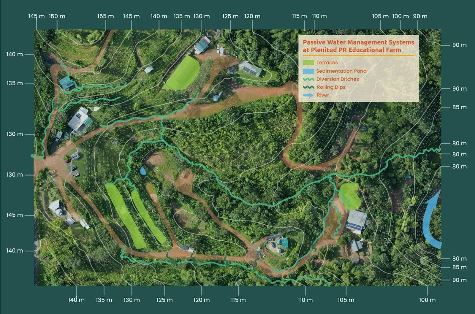
The Plenitud PR farm has been designed and developed following the principles of permaculture and water harvesting. We are located in Las Marías, a town in the mountainous region of the island where rain is very abundant. Below, you can see the location of Las Marias in Puerto Rico.  These factors make for an interesting combination, because mountains have steep slopes and the rain results in lots of runoff. This can be a very bad combination without proper planning, because it leads to intense soil erosion, losses of crops, and major landslides. However, even with some of the most intense rain events on record, our farm has not seen any major problems. Why? Plenitud PR uses a combination of different passive water management systems that work together with the natural landscape and elements to control runoff and promote water infiltration in the soil. These systems also build soil fertility, provide habitat for wildlife, and produce yields of fruits, fuel, building materials, and more! Below, you can see an elevation map of our farm and the different passive water management systems that we have been able to implement throughout the years. You can also see the solid and dotted white contour lines on the map. Every point on a contour line is at the same level or elevation. This is a key concept we will explore more later.
What are some types of water management systems?
In Module 1, we saw that as part of any water management system, there are elements that move water and others that store water. Similarly, there are different types of passive water systems for different purposes and topographies. Use the arrows on either side of the slide deck on Water Management Systems (when you hover over the edges) to navigate through the content. There are also embedded videos to watch within the slide deck.
Case Study: Passive Water Harvesting in Urban Seattle
The following video shows an example of a passive water harvesting system spread out over several blocks in the city of Seattle, Washington. With a majority of the global population residing in urban areas, it is essential for urban planners and municipal governments to implement these technologies in order to reduce the environmental impact of densely populated areas and improve living conditions.
How to understand slope in my area
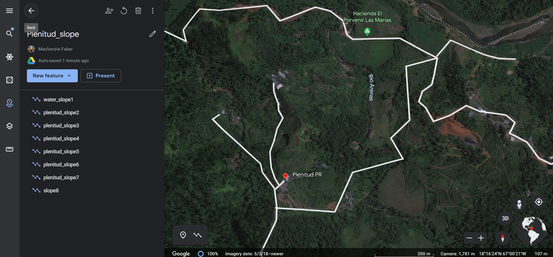
To begin understanding how slope affects the movement of water in your community, we need to begin with the first principle of passive water management: observation. A good open source online tool that you can use to begin to visualize the topography of your area is Google Earth. Google Earth is a platform for geospatial information. There is both an online and desktop version, the desktop version is ideal for exploring your area’s topography. You can download it at Earth Versions. Below you can find an example of the view of the Plenitud farm from the desktop version. With this tool we can get a general sense of the direction of slope (and therefore water) in our farm. Here is a 2D aerial (top view) of the farm.
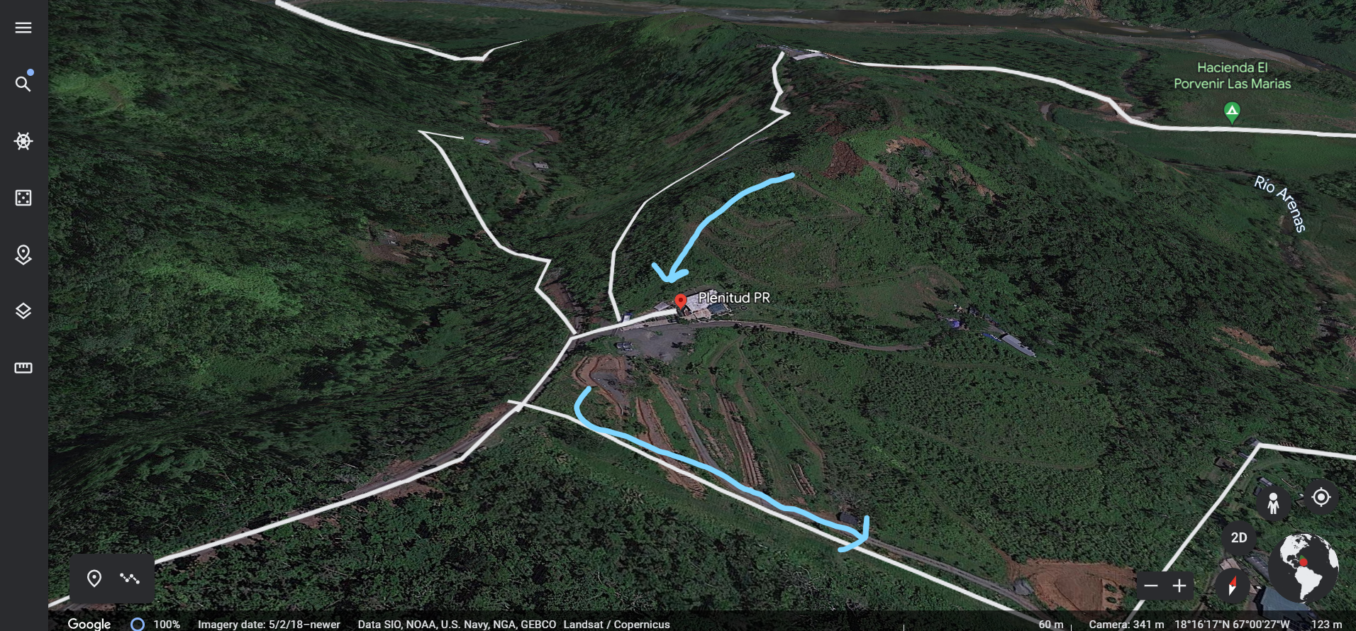
Here is a 3D view of the farm with arrows pointing to the downward direction of slope on the farm. You can vaguely see the curve of the hills.
See the following intro video on the basics of Google Earth, and then find your community or area in Google Earth. Explore the topography of the area with the 3D rotation tool, paying attention to elements like steep or flat slopes.
How to measure slope In this video from Plenitud PR, you can find an introduction to DIY slope measuring tools that you can build in your home with simple materials.